We hope that you find the enclosed material helpful as you join us in the stewardship of this beautiful natural resource. Some history… Excerpt from North Lake 1860-1960
“The dimensions of the prehistoric glaciers that moved over this area that is now Wisconsin, have been checked quite accurately. Parts of their furrowed and uneven bottoms, that in places dug deeply into the earth’s surface before breaking off, later melted and made lakes. A southeastern part of Wisconsin that was later called Waukesha County contains a range of hills (moraines) and a series of lakes (kettles) that were left by the last of the departing glaciers. The lake furthest north was called North Lake, one of the most scenic parts of the Kettle Moraine region. The first pioneer arrived about 1837, but the roaming Winnebago and Potawatomi Indians were the first resorters. Camping on the shore, with their birch-bark canoes floating on the placid lake, they made a beautiful picture, when, on many a hot summer day, the cream-colored thunder heads were distinctly reflected in the cool clear water.”
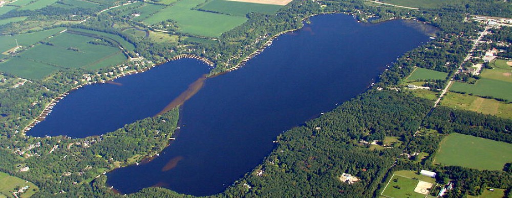
Statistics…
- The size of the lake is 438 acres.
- The deepest spot in the lake measures 78′
- Property owners currently number 238.
- The four inlets are Big and Little Oconomowoc Rivers, Mason Creek and an inlet from Cornell Lake.
- The one outlet is the Oconomowoc River to Okauchee Lake.
See following map:

North Lake Map – Detailing Inlets and Sand Bars

You must be logged in to post a comment.